Yedioth Ahronoth 31 May 2003

Above: Israeli construction workers lower another section of the wall into place near Qalqiliya. (Ronald de Hommel)
At the end of September, so the Internet site of Matan proudly relates, the director general of the Defense Ministry Amos Yaron and Haim Ramon, then the chairman of the Foreign Affairs and Defense Committee visited the site and said, “It would be a mistake to have territorial contiguity between Kalkilya and Habla.” On September 25, Amikam Svirski, the defense minister’s adviser on settler affairs, sent them a letter with the good news. Your position has been accepted. “We’ve gone very far from the original plan,” Hasdai boasts, “We’ve moved the Green Line.”
Changing the route cost Israel a lot of money. NIS 130 million, Hasdai estimates. The Settlers Council, he relates, were a bit envious of him, they said he’d only succeeded because he was a member of the Likud Central Committee and Sharon needed him in the primaries. Hasdai dismisses this. “It wasn’t because I’m a Central Committee member that NIS 130 million was spent on the fence in Alfei Menashe,” he says. “I won because I stressed that we are situated on the first mountain chain after the coastal plain, and we could serve as a security barrier.”
Alfei Menashe and Matan’s success was a catastrophe for Kalkilya. The city became an island surrounded by fences on four sides, cut off from the villagers that bring it goods and do their shopping and depend on it for civil services. But, as Uzi Dayan says, “The fence isn’t supposed to make everybody happy. There was no choice.”
On paper, the planners looked out for the Palestinians’ rights. Mashiah relates that the farmers whose land was taken for the fence were given seven days to submit their reservations, and in some cases, were given a further extension so they could petition the High Court of Justice. In practice, there was little consideration of the Palestinians. Mashiah relates that in only one place, near Umm el-Fahm, were the Palestinians’ reservations on the fence’s route accepted.
So in what way were the fence builders considerate? The ancient Egyptian city discovered near the Taibe roadblock delayed work there by two months. In order not to harm the Gilboa irises, it was decided that the width of the fence (the barbed wire, the ditch and the fence) in the Gilboa reserve would only be 35 meters and not 80, as it is in the Tulkarm and Kalkilya area. Israel appears to care more about flowers and antiquities than people.
The original plan called for a complex system of gates: five controlled crossings similar to the Erez crossing, and another around 30 “farming” gates through which fallahin who have land west of the fence could cross. The Civil Administration was to provide permits for those with land beyond the barrier and to allow medical teams or teachers cross the barrier. It was on the basis of these promises that the High Court of Justice denied the petitions of the Palestinians against the fence.
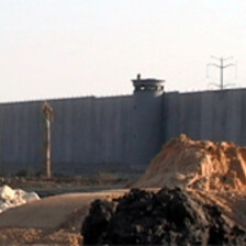
The security establishment now admits that there is no chance that the terminals meant to channel civilians and goods will be ready by July, at which time the first section of the fence will be completed and become operational. “There are seven control points for Jews and nine for Arabs, and they will be operated the moment the fence is operated,” the army says officially.
The matter of the crossings also tends to become blurred. In reply to a query in the Knesset, Defense Minister Mofaz said: “At this time there is no budget for farming crossings.” The Palestinians say, for example, that in the section already paved between Kafin and Shweika, which according to the map is to have eight farming crossings, there is not even one. And even if there were, it is unclear who can cross and when. All attempts by the attorneys of the Palestinian landowners and of B’Tselem to receive clarifications were rejected with the reply that “the matter is being examined.” Even to the question as to what time the farming crossing would open (the fallahin go to work at 4:00 in the morning), and would it be open all year, there was no reply.
Contrary to Palestinian claims, army officials say that the farmers’ gates are part of the fence, and they are all ready. “The question is when and how they will open, but that’s not our affair, that is a matter for the Civil Administration.” Abu Mazen raised the issue in his first meeting with Sharon and Sharon himself promised, the newspapers reported, that nobody would block the farmers from getting to their lands. “You should realize that I am a fallah. I know what attachment to the land is, and that is why I ordered that many gates be opened in the fence to let the farmers work their land. The fence is not a border,” Roni Shaked quoted Sharon in Yedioth Ahronoth. However, as said, there is still no clear procedure in the Civil Administration to arrange the crossing. The Civil Administration refused to comment.
IDF officials say that the farmers will be allowed to cross to their land with no problem, “after they prove they have rights to the land.” Army officials say there is a plan to define clearly who exactly has the right to cross the fence, “but it is still too early to make this public.” In any case, if it turns out that a Palestinian who has to cross the fence for farming or other matters has a “security past,” his chances of reaching his destination are nil. “You don’t build a fence at an investment of millions to be like Swiss cheese, where every senior Hamas wanted man can cross because they have land beyond the fence,” army officials say. Mashiah sounds even more adamant: “Even if the fallah’s son has a security past, he won’t cross. The fallah should take this into account. And if even one terror attack manages to get through a farming gate, this crossing will turn into a wall. Nobody will cross.”
Mashiah promises to hand over the first section of the completed fence this July. At this time the plan is being drawn up for the rest of the fence. This has been totally changed. Before Ben-Eliezer left the Defense Ministry, the ministry had drawn up a plan for the rest of the fence. “There was a general order to continue the route,” says Ben-Eliezer, “as close as possible to the Green Line.” Security sources involved in the fence’s construction confirm that this was the order, and that the first maps were drawn accordingly.
These plans were thrown in the trash. “I fought against this plan from the start,” says Ron Nahman, mayor of Ariel. “Fuad and the Labor Party wanted to abandon us, to leave 50,000 Jews outside the fence.” Nahman met with security establishment leaders, and proved to them with numbers that in his area there are more Jews than Arabs, but nothing helped. That is until the second Sharon government came to power. In early May Mofaz told him festively that it was decided for good that Ariel would be inside the fence. Along with Ariel, the settlements of Elkana, Maale Shomron, Karnei Shomron, Kedumim, Emanuel, Pduel and Alei Zahav would be included. The last two settlements are ten kilometers away from the Green Line.
Pinhas Wallerstein, head of the Binyamin Regional Council, says that in the last few days he has been meeting with army commanders in the area over the maps and trying to persuade them to also include what is known as “the Talmonim bloc” (five Jewish settlements northwest of Ramallah, about 20 kilometers from the Green Line) into a “balloon,” as was done around Alfei Menashe. If this plan is realized (“I won’t say I have their consent already,” says Wallerstein), this would mean that the separation fence would look like a string of Norwegian fjords. And the difficulties the Palestinian residents have along the section now being completed would be child’s play in comparison.
These plans outrage Fuad. “I very much hope this doesn’t happen,” he says. “It is both expensive and it complicates the pursuit of terrorists and will make it difficult to maneuver troops.” Military officials involved in planning the fence share Fuad’s opinion. For the fence to be effective, they say, it has to be as short and as straight as possible. What is happening is exactly the opposite.
Military sources involved in the fence say that the security establishment has basically completed drawing the route of the fence from Elkana to Camp Ofer - exactly 210.5 kilometers. “Now we are only waiting for the budget and we’re off.” And the matter of the budget is no minor matter. Originally, when Ben-Eliezer was defense minister, this section was to be 100 kilometers. “Another 110 kilometers were added, because it was decided that the fence would also surround Israeli settlements in the West Bank,” say military sources.
A simple calculation shows that this addition will cost the taxpayer around NIS 1.3 billion. And this is a moderate estimate. “South of Elkana the region is more difficult. It could cost more,” say army sources. “It would be cheaper to give each resident of Kedumim a villa in the center of Israel than to build this fence.” The delay in building the fence is also liable to be long. The new route is complicated and goes through mountains and is also liable to raise tough legal problems, army sources say. The Finance Ministry also doesn’t know where precisely it will get such sums.
None of this interests Ron Nahman. “I reject all of Fuad’s statements and his bunch,” he says. “Who are these army people? What do they understand that I don’t understand, they have nothing to teach me. Nu, so what’s the big deal if the fence is lengthened another 60 kilometers. Aren’t 50,000 Jews worth it?”
In the opinion of the Defense Ministry, the settlers in Samaria are worth it, and how. At precisely this time, the region is being mapped from the air, and around ten planning offices are working on preparing the maps. The Prime Minister’s Office said that discussions on the fence route from Elkana to Jerusalem “are taking place at this time, and the government’s decision will be made at the time set,” but in an interview to The Jerusalem Post last week, Sharon left no room for doubt. Ariel and Emanuel will be west of the fence, he said. These additions very much lengthen the fence. The original plan was for 350 kilometers of fence. Now the fence is 650 kilometers, in other words, another NIS 4.5 billion. And this is without counting the fence along the mountaintop.
A look at the map leads to a simple conclusion - the separation fence being built at this time basically overlaps the Sharon map for a Palestinian state. A bit more than 40% of the West Bank, split and sliced into pieces. The northern West Bank is cut off from the southern West Bank and to go from Bethlehem to Ramallah a Palestinian will have to cross two border crossings.
The system of internal fences, “open prisons” the Palestinians call them, will be even more sophisticated in the new section. For example, the fence is meant to go on the eastern side of road 446 and leave the settlements of Ofarim, Beit Aryeh and Nili on the Israeli side. In the middle there will be about ten large Arab villages such as Kibiya and Rantis imprisoned behind another fence in the shape of a loop. These ten villages will have only one exit to the east, to Ramallah, through a control point in the “main” fence. A similar loop, with another internal fence, will be extended south of road 443, the Modiin-Jerusalem road, and will also include about ten villages. Jamal Juma of the Palestinian Environment Association says that around 50,000 people live in these enclaves alone.
“It would not be an illusion to speak of cantons,” says Uzi Dayan. Dayan thinks that all this preoccupation with extending the fence is in fact meant to delay its construction because Sharon and Mofaz don’t want a fence. Perhaps there is something to this. Army officials say that building the new section, from Elkana to Ramallah, will take a year and a half to two years, because it is winding and more complicated than the first section, whose construction took exactly a year. Only afterwards will construction on the fence in Judea begin. “The fence could have been finished a long time ago,” says Dayan, “Sharon and Mofaz are not working on the fence. That’s it. Everything else is immaterial. They are trying not to do it. I don’t believe there is a master plan. If there was, the fence would have been up.”
He could be right. But he could very well be wrong. Sharon is known for his affection for creating facts on the ground. According to the Palestinians’ calculations, almost 400,000 Palestinians (around 20% of West Bank residents) including residents of the neighborhoods and villages around Jerusalem will be on the “Israeli” side of the fence. The 80% on the Palestinian side of the fence will also find it very hard to move from place to place without Israeli permission.
The road map talks about a Palestinian state by the year 2005 in “viable” borders. It’s hard to see how anyone can live within such borders. And perhaps that is precisely Sharon’s plan. Just like he initiated the settlements to mark the future borders of Israel, now he is marking them by means of the fence. And it will be very hard to move this fence.
“You leave us no room to grow, you leave us no room to live,” says Jamal Juma. The only thing left the Palestinians is to live in huge pens and to work in industrial zones that will no doubt be built in the settlements, near the openings to these pens. “You want us to live like slaves. It won’t work. If you had built the fence along the Green Line, there would be no problem. This way perhaps you’ll have quiet for four-five years, but you will create only hatred. Instead of 20% Hamas, you’ll have 60%.”
This article was first published in Hebrew in the Israeli newspaper Yedioth Ahronoth, on 23 May 2003 under the title “A Wall in the Heart”. Translation by Israel News Today.