UN Office for the Coordination of Humanitarian Affairs 19 December 2004
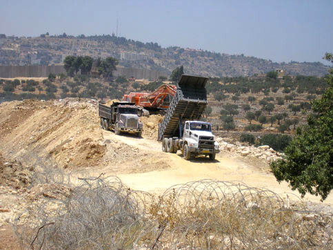
Construction of the Wall in Beit Jala in June 2004. The Bethlehem area, including Beit Jala and Beit Sahour, is currently surrounded by 15 km of Segregation Wall with an Israeli approved plan of an additional 35 km of wall of which construction is underway. (Arjan El Fassed)
The glory of Bethlehem, a city of historical and religious importance for those of the Christian, Muslim and Jewish faiths alike is vanishing. Surrounded by Israel’s Barrier on two sides and restricted roads and roadblocks on the other, urban Bethlehem1 has become isolated from the rest of the West Bank and most importantly, from Jerusalem.
Straining Links Between Bethlehem and Jerusalem
The spiritual, cultural and economic lifeline of Bethlehem has traditionally been tied to Jerusalem, located just a few kilometres away, allowing residents of both cities to freely visit their holy sites. Today, this centuries-old link is being undermined. A number of Israeli settlements have been built around Bethlehem. Additionally, movement restrictions for Palestinians have been tightened due to the security situation with the aim of protecting Israeli civilians from suicide attacks and other violence.
Bethlehem’s self-sufficiency has also diminished with the loss of tourists and pilgrims due to the conflict and to movement restrictions. Before the intifada the people of Bethlehem had a much lower rate of dependency on Israel for work than most other urban centres in the West Bank as they were able to rely on tourism. Today with the tourism sector decimated, most residents can barely make a living.
From 1967 until 1995, Bethlehem was occupied by Israeli forces. Following the Oslo agreements, the Israeli army withdrew from Bethlehem’s urban centre and the Palestinian Authority took control. With the outbreak of the second intifada, the Israeli army reoccupied the city and blocked the roads leading in and out of the district. In 2002, Bethlehem was placed under 24 hour curfew for 156 days.2
Urban Bethlehem has a population of 60,989 residents.3 Another 14,168 refugees live in three refugee camps in Bethlehem. Before the outbreak of the second intifada in September 2000, the population of urban Bethlehem was evenly divided between Christians and Muslims.4 However, this has changed as many Christians have left for other countries (See Table 5 at page 20). The only recreational ‘green’ area available to residents of Bethlehem is at risk of becoming inaccessible after the Beit Jala- Walaja section of the Barrier5 is built. Israeli policies, including Israeli settlements, restricted roads and the current and planned route of the Barrier do not allow space for Palestinian population growth and urban development.
Footnotes
Related Links